

New Altai Mountains Resort
Territory in the Chashino, Sargata and Tours zone for the formation of the second winter center of the Karakol direction with accommodation, services and a year-round resort program
97.4074 ha
04:05:050204:10
Karakol Lakes, Chemal District
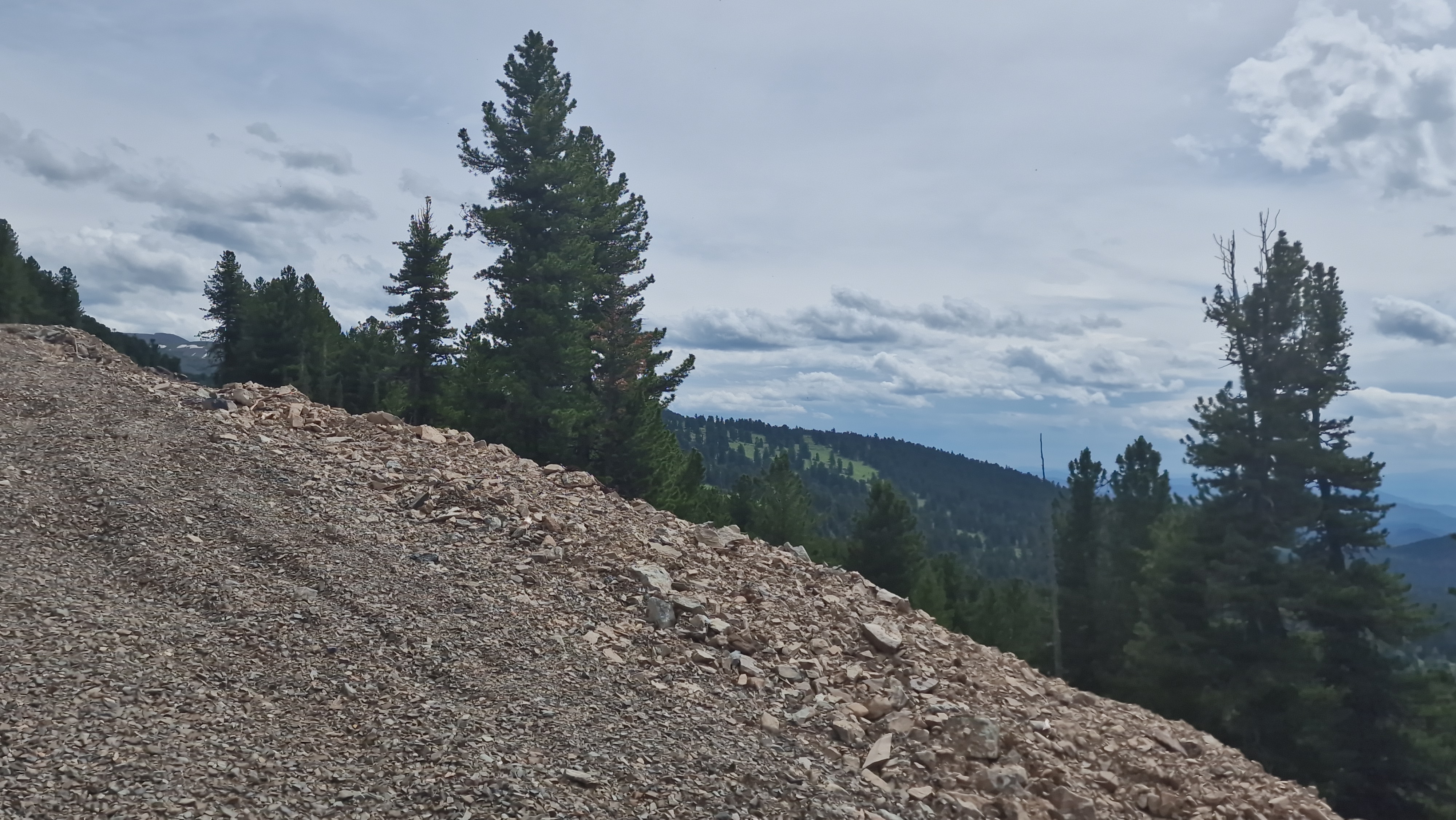
The new Altai Mountains Resort is a promising land area in the Karakol direction of the Chemal district, in the Chashino, Sargata and Tura zone. The location is considered as a platform for the formation of a second winter center next to the route of the Karakol Lakes: with ski slopes, lower service base, glampings, apart-hotels, natural hotels and a year-round recreation program.
The value of a site is not determined by a single site, but by the structure of a place, where there are mountainous terrain, open slopes, forests, elevation transitions and lower zones, where the operational infrastructure of a future resort can be located, and this combination allows you to view the land not as a point sale, but as the basis of a resort hub with phased development.
Land under the second winter center of Karakol direction
Karakol is already linked to summer tourism, routes, horse-drawn programs, trekking and trips to the Karakol Lakes, but moving to a year-round model of the territory requires not only summer flow, but winter product: slopes, service, accommodation, rental, food, routes and managed resort environment.
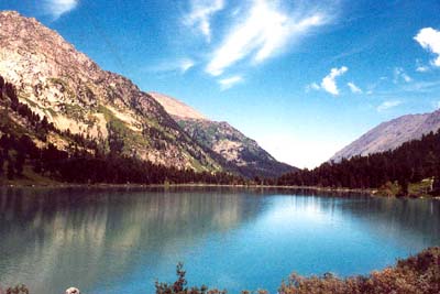
The Chashino, Sargata and Tours zone is interesting in this logic, and it could be the second winter point in the Karakol direction, where the lower sites work for the base, services and accommodation, and the upper and slope sections form a sports, walking and view scenario, which enhances not one object, but the entire territory around the route to the Karakol Lakes.
Mountain relief, slopes and forest as the basis of the resort project
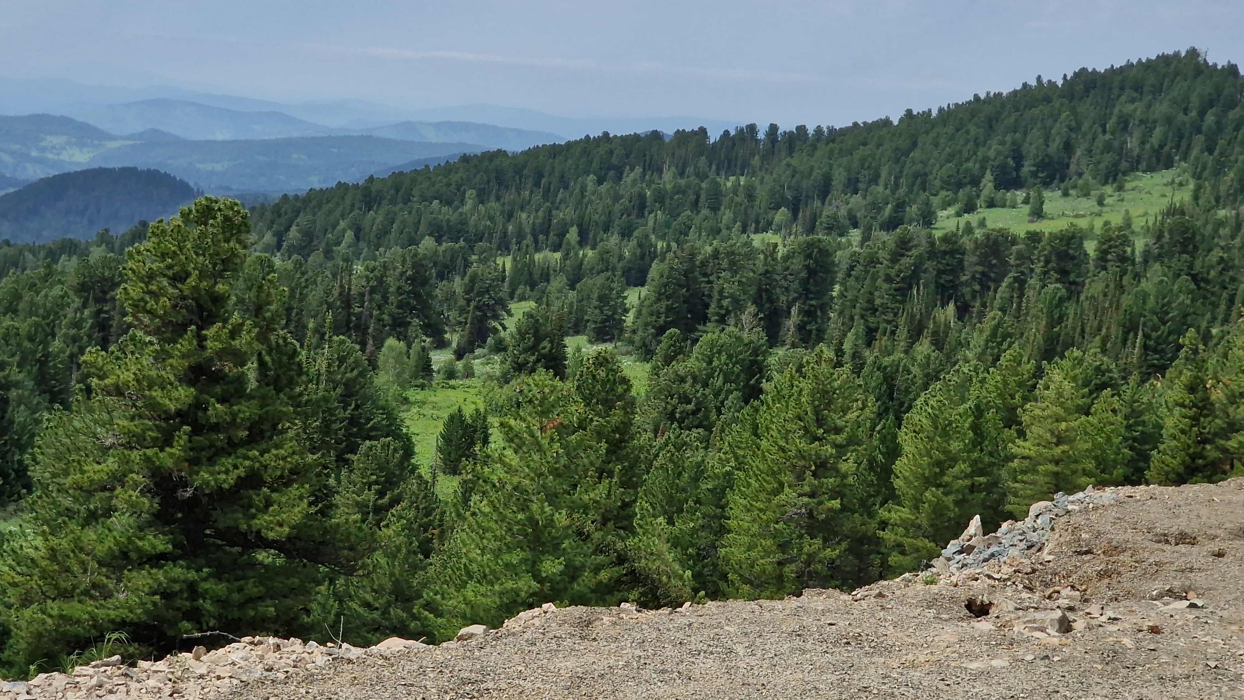
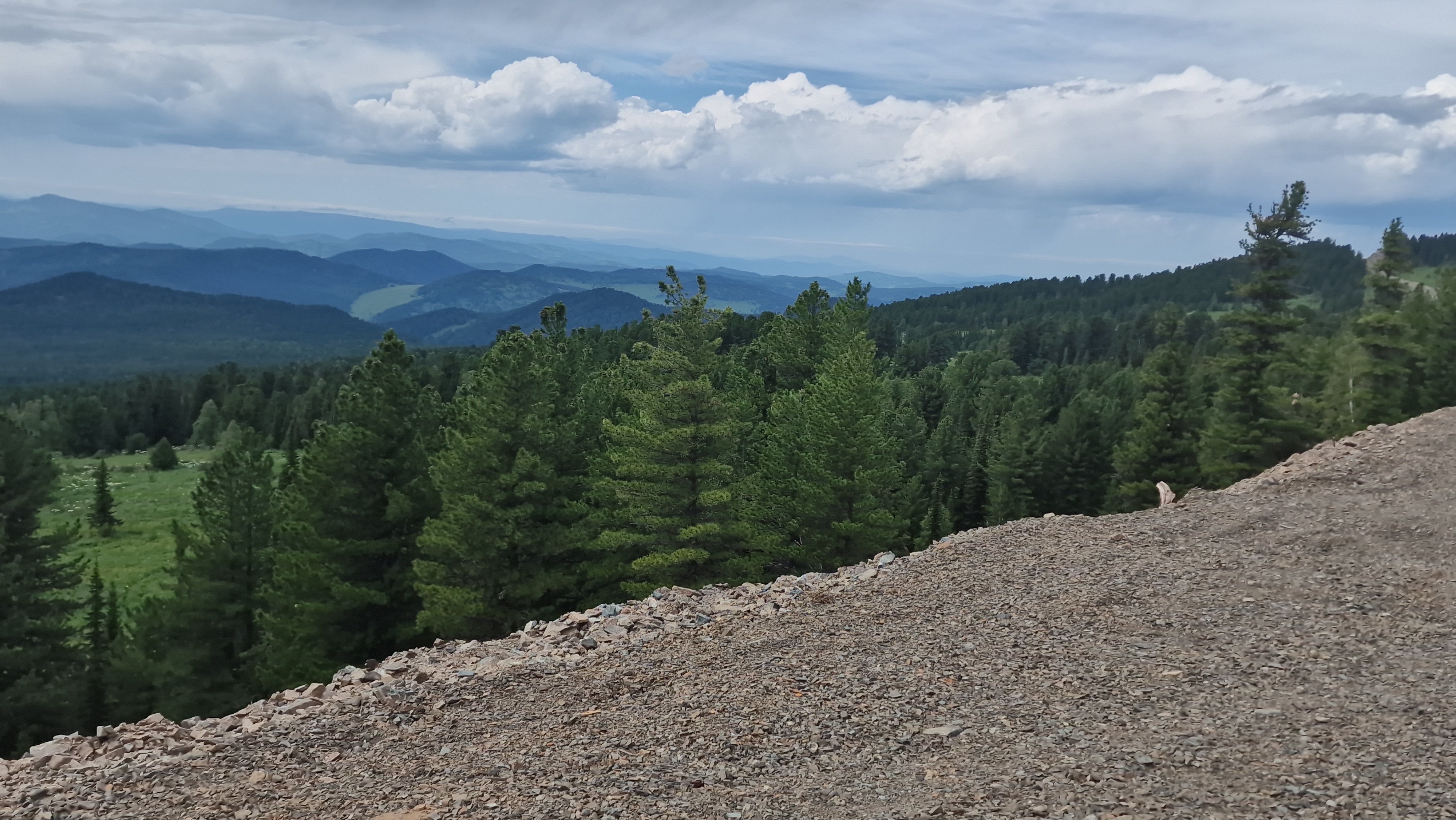
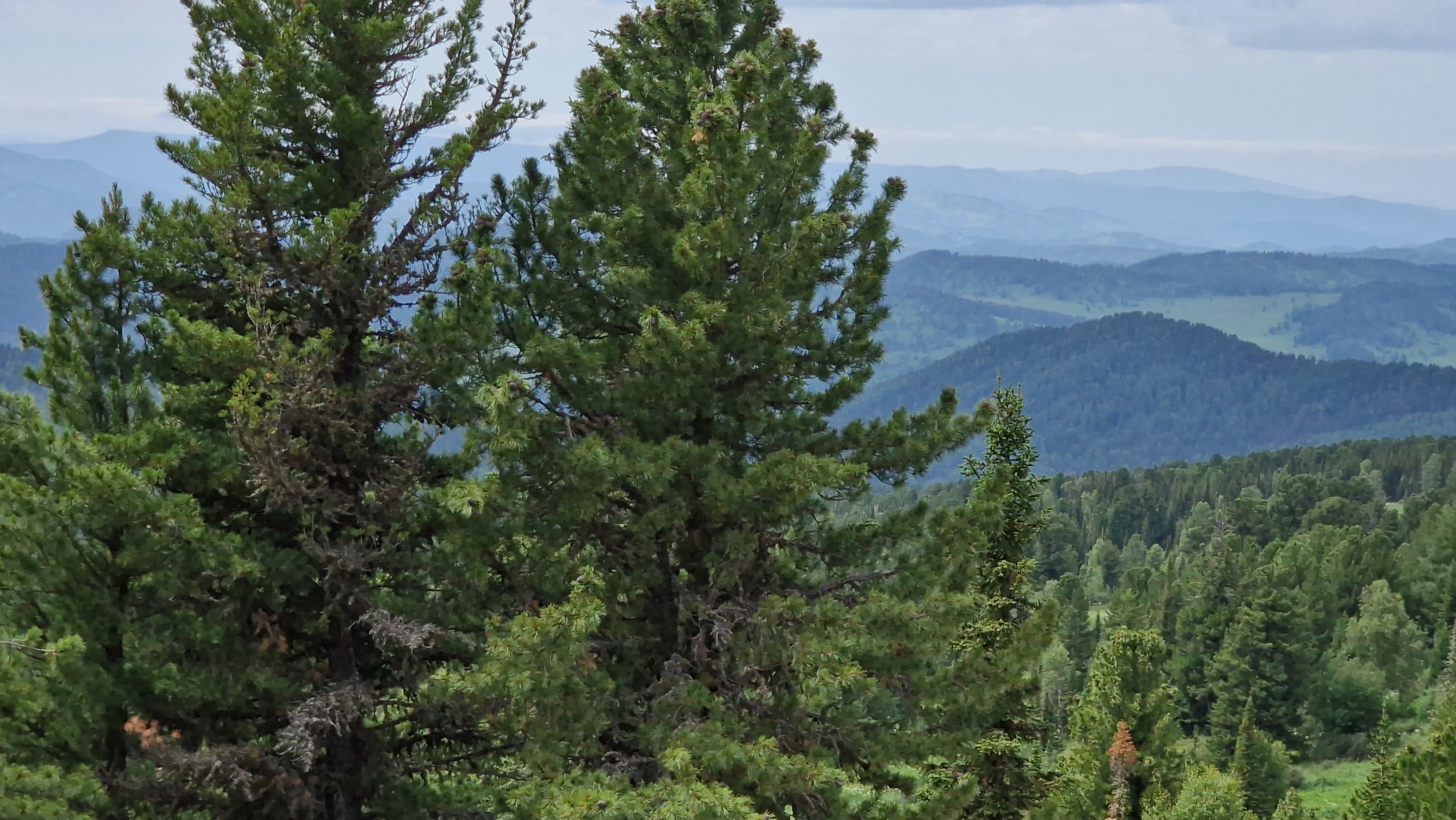
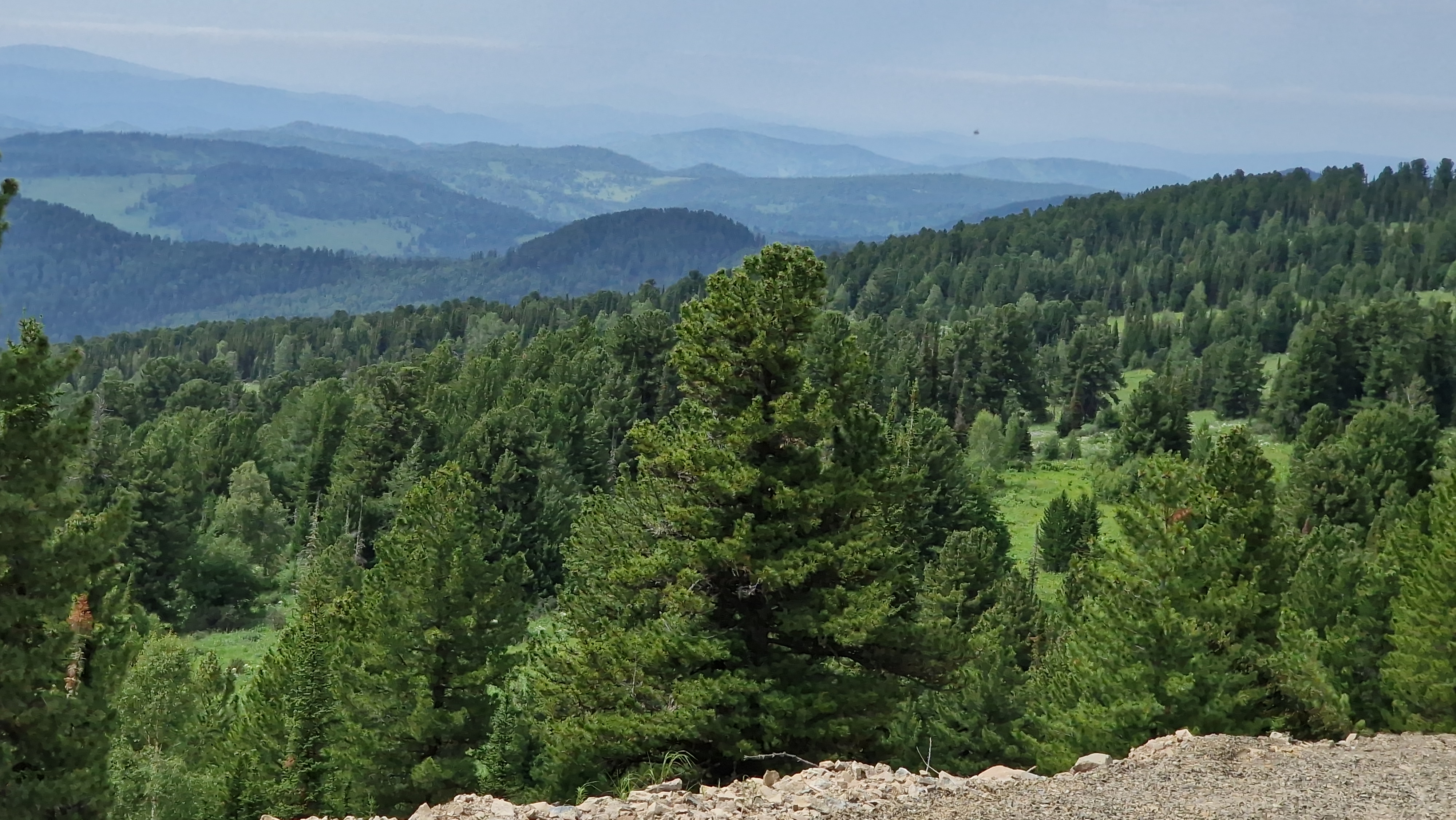
The main advantage of the location is the natural readiness for resort zoning. The terrain here does not interfere with the project, but sets the internal scheme. The slopes can be used for winter skiing, species routes and individual lodges. Forest areas are suitable for glamping, chamber residences and natural hotels. Lower areas logically set aside for entry, parking, reception, rental, restaurants, technical services and public spaces.
For a developer, this means that you can work not with a flat field, where you have to create an image of a resort artificially, but with an area where the script is already read through the relief, which requires serious engineering testing, but gives more options for design packaging, from a small first stage to a full-fledged mountain resort center.
The lower base of the future resort: services, rental, restaurants and accommodation
The second winter center can't be built on the slopes alone, it needs a lower base where the guest arrives, leaves the car, gets the service, rents the equipment, settles in, eats and starts the route, and it's the lower zone that makes the mining project run by a business, not a set of disparate plots.
In this location, the lower base can include parking areas, entrance group, rental, service center, cafes and restaurants, aparthotels, guest buildings, warm glamping, bath complexes and technical infrastructure, and if properly designed, it will become the operational core of the future resort and the point through which the main cash flow passes.
Glampings and Aparthotels on the Winter Route
For the first stage of development, flexible accommodation formats are particularly suitable: warm glamping, modular houses, low-rise aparthotels, natural hotels and club residences, which allow you to launch the territory in stages without freezing all the capital in one major construction cycle.
Glampings can be placed closer to forest and viewpoints, aparthotels in more accessible lower areas, service facilities at the entrance and main routes, and this allows you to separate private accommodation, public areas and maintenance. For the buyer and the investor, this increases the clarity of the project: the land is immediately linked to a specific use model.
Year-round resort near Karakol Lakes
The strength of this territory should not be limited to the winter season, but in the summer it can operate routes to the Karakol lakes, walking trails, horse-drawn programs, viewing grounds, bath complexes, family vacations, retreats, restoration programs and natural hotels, in winter the territory receives another product: skiing, snow, warm accommodation, rental, restaurants and evening services.
A year-round model is important for the economics of a project, which reduces dependence on the short season, increases the load of accommodation, and makes land more interesting for the developer, operator and investor, but this scenario requires not a promotional promise, but a master plan, engineering calculations, a transport scheme, snow load checks, availability and real tourist flow.
Why this land is interesting to the developer
For the developer, the New Mountain Resort of Altai is interesting as a territory where you can generate value through a project, not only through the resale of land. The land gets additional meaning after zoning, road scheme, first stage of accommodation, launching services and creating an understandable resort product.
So you can do a phased model, first the inlet infrastructure and the first accommodation, then the glamping block, the service center, the rental, the restaurant area, then the aparthotels, the residences and the expansion of the winter program, which allows you to not start immediately from a heavy resort full scale, but to increase the value of the territory through managed queues.
Investment sense of location
The investment sense of the territory is associated with the early entry into the Karakol direction before its full infrastructural disclosure. If in the future the direction is strengthened through roads, tourist flow, winter product, accommodation and services, land masses with the right relief and design logic will receive a higher interest of the market.
This conclusion cannot be presented as a guaranteed increase in price. The correct position is different: the territory has signs of future resort value, because it connects the route to the Karakol lakes, mountainous terrain, forest, potential slopes, lower zones for service and the possibility of gradual development. For the investor, this is not a speculative purchase “on hearsay”, but the entrance to the project land with an understandable logic of development.
What formats is the territory suitable for
The new Altai Mountains Resort fits several related scenarios: a winter resort center, a lower base of the ski zone, a glamping city, a natural hotel, apart-hotels, club residences, a service center of the route, rental, restaurant block, bath complexes, viewing areas and a land bank under the long horizon.
The most powerful model is not to choose one format in advance, but to assemble the area as a resort cluster. The bottom part works for arrival, service and accommodation. Forest zones give privacy and natural product. The slopes and tops form winter and species value, in which case each site within the territory gets its function.
What to check before designing
Before the project is launched, a separate engineering and legal check is required: we need to assess the entrance, the possibility of building roads, slopes, avalanche and erosion risks, snow and wind load, water supply, electricity, sewerage, seismic, land status, restrictions on use, the possibility of locating capital and non-capital facilities.
You also need to test the actual potential of the slopes for winter use, not every slope automatically fits under the track, you need topography, geology, exposure analysis, elevation differences, safety, lifts, routes and operating costs, and then you can translate the concept into a full master plan.
Practical conclusion for the buyer and investor
The new Altai Mountains Resort is not a random purchase area, but a projected entrance to the Karakol direction, and its value is revealed through the relief, forest, lower base, winter scenario, accommodation, services and connection with the route of the Karakol Lakes.
The buyer of a private plot is concerned with the quiet, nature and prospects of the development of the direction. The developer is concerned with the scale, zoning, first stage and operating model. The investor is concerned with the horizon in which the land can be strengthened after the emergence of roads, services, accommodation and winter product. The main purpose of the territory is to form a new mountain resort hub, rather than just sell individual plots in a beautiful place.
Parameters on request
Cadastral numbers
- 04:05:050204:10 with an area of 43.9751 ha
- 04:05:050204:11 with an area of 11.8142 ha
- 04:05:050204:12 with an area of 16.5968 ha
- 04:05:050204:596 with an area of 11,181 ha
- 04:05:050204:598 with an area of 4.1041 ha
- 04:05:050204:589 with an area of 0,1002 ha
- 04:05:050204:590 with an area of 0.1123 ha
- 04:05:050204:591 area 0.1469 ha
- 04:05:050204:592 with an area of 0.1873 Ha
- 04:05:050204:593 with an area of 0.137 ha
- 04:05:050204:594 with an area of 0.1357 ha
- 04:05:050204:595 with an area of 0.1709 ha
- 04:05:050204:461 area 0.1233 Ha
- 04:05:050204:462 with an area of 0.1212 Ha
- 04:05:050204:463 area 0.1792 Ha
- 04:05:050204:464 with an area of 0.1351 Ha
- 04:05:050204:465 with an area of 0.1577 Ha
- 04:05:050204:466 area 0.1798 Ha
- 04:05:050204:467 with an area of 0.2308 ha
- 04:05:050204:469 with an area of 0.1273 Ha
- 04:05:050204:470 with an area of 0.1605 ha
- 04:05:050204:471 with an area of 0.1049 ha
- 04:05:050204:468 area of 0.18 ha
- 04:05:050204:102 with an area of 6,246 ha
- 04:05:050204:472 with an area of 0.16 ha
- 04:05:050204:473 area 0.16 Ha
- 04:05:050204:474 with an area of 0.1603 ha
- 04:05:050204:475 with an area of 0.1605 ha
- 04:05:050204:476 area 0.1593 Ha
The total area is 97.4074 ha.
Distance to Gorno-Altaisk Airport (RGK) is 116 km.
Distance to the bus station Gorno-Altaisk 122 km.
Distance to railway station Biysk 211 km.
Distance to the village of Uznezja 41 km.
Land category: Agricultural land
Type of permitted use: for agriculture.
Right: Private property.
|
Recommended appointment
? Categories/Usage scenarios |
Land for long-term lease, Land for agrotourism and farm tourism, Massives for investors and developers, Sites for capitalization - undervalued plots with high growth potential, Glamping plots, Sites for hotels and recreation centers, Land for houses, estates, private estates and residences, Sites for roadside business |
|
District
? District |
Chemal District |
|
Location type
|
In the forest, Panoramic view, Hard access, At the sights, At the track, Secluded location |
|
Pond/river/lake
|
Lake |
|
Square, HA
|
97.4074 |
|
Attraction
|
Karakol Lakes, Chashino, Sargat, Tura |
|
Large array
|
Yes. |